1.05 Why Here? Where Resources Are and Why
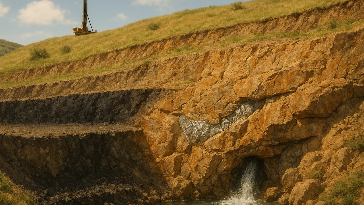
use maps and rock evidence to explain why coal, oil and gas, metal ores and groundwater are found only in certain places.
- I can identify and describe examples of mineral, energy, and groundwater resources and where they are found.
- I can describe evidence of the geologic processes that formed each type of resource, such as volcanic activity or sedimentary processes.
- I can explain how human extraction of resources changes how much and where those resources can be found.
- I can explain how past and current geoscience processes have caused the uneven distribution of Earth’s mineral, energy, and groundwater resources.
- I can describe why these resources are usually limited and nonrenewable, including how long they take to form and how rare their formation is.
- I can use reasoning to connect evidence and explain how Earth’s resources are formed by geologic processes.
- I can describe why resources are found only in certain places or times, based on the specific environments or conditions that formed them.
- I can explain how resources are depleted as they are used and how they can be replenished, mainly through geologic processes.
Phase 2: Investigate
Warm-Up ~5 min
Do Now. The road cut has a black coal layer, but the hills across the river do not. List two possible reasons a resource could be in one place and not another.
Coal forms from buried plants. Where would you search for coal?
Instruction ~10 min
Explore first: four resource stations. Rotate through four stations, each with a rock sample or picture, a simple map and a clue card. At each station, record what the resource is, what kind of rock or setting holds it, and what past process might have put it there.
| Station | Resource | Rock or setting it is found in | Past process that formed it | Renewable on a human time scale? |
|---|---|---|---|---|
| 1 Black, light rock with leaf prints | ||||
| 2 Sandstone that smells faintly of oil | ||||
| 3 Quartz vein with shiny metal grains | ||||
| 4 Sand and gravel jar soaking up water |
Name the ideas. Resources form only where the right conditions came together, so they are unevenly distributed. Coal formed from swamp plants that were buried before they rotted, then compressed and heated. Oil and natural gas formed mostly from tiny sea organisms buried in mud, then “cooked” by heat deep underground; they collect in porous rock under a cap of tight rock. Metal ores often form where magma or hot fluids deposited metals in cracks, which is common near past or present plate boundaries and volcanoes. Groundwater fills spaces in sand, gravel and porous rock called aquifers, which rain and snowmelt refill.
Worked example 1: coal in one hill only. The road cut’s coal layer formed in a swamp about 300 million years ago (sample date). Across the river, erosion stripped those layers away long ago. Same past swamp, but only one side still has the layer. Formation and later erosion both shape where a resource is today.
Worked example 2: groundwater under the valley. Rivers drop sand and gravel on their floodplains. Those loose deposits have many connected spaces, so they hold and pass water well. That is why the town’s wells sit near the river, while wells drilled into the tight shale of the hills give little water.
Worked example 3: running out. Coal, oil, gas and ores take millions of years to form, so they are nonrenewable on a human time scale. Once mined, they are gone. Groundwater refills, but if wells pump faster than rain recharges the aquifer, water levels drop.
Guided Exercises ~15 min
Use your station notes. Discuss with your team before answering.
Independent Practice ~10 min
Gather evidence from more than one source.
Choose one resource from today. Explain where it is found and the past process that put it there. Use two sources of evidence, such as your station sample and the map card.
If the town pumps its wells harder every summer, what could happen to the aquifer? Explain how it could recover.
Closure ~5 min
Past processes decide where resources are. Next time, we use data to see where and when hazards strike.
Exit ticket: why does a resource map look patchy instead of even? Use one specific resource in your answer.
Teacher notes
Materials: coal or a coal picture, an oil-sand or sandstone picture, a quartz sample or photo with metal grains, a jar of sand and gravel with water, four generic map cards (swamp-age layers, a buried sea basin, an old volcanic belt, a river floodplain).
Listen for: “oil comes from dinosaurs” (mostly tiny sea organisms) and “groundwater is an underground lake” (mostly water in spaces between grains).
Support / stretch: give a cause-and-effect frame: “___ formed here because long ago ___.” Stretch: explain why mining changes how much of a resource is left and where.