3.02 Project Brief and Wonder Board: The Fault Crossing
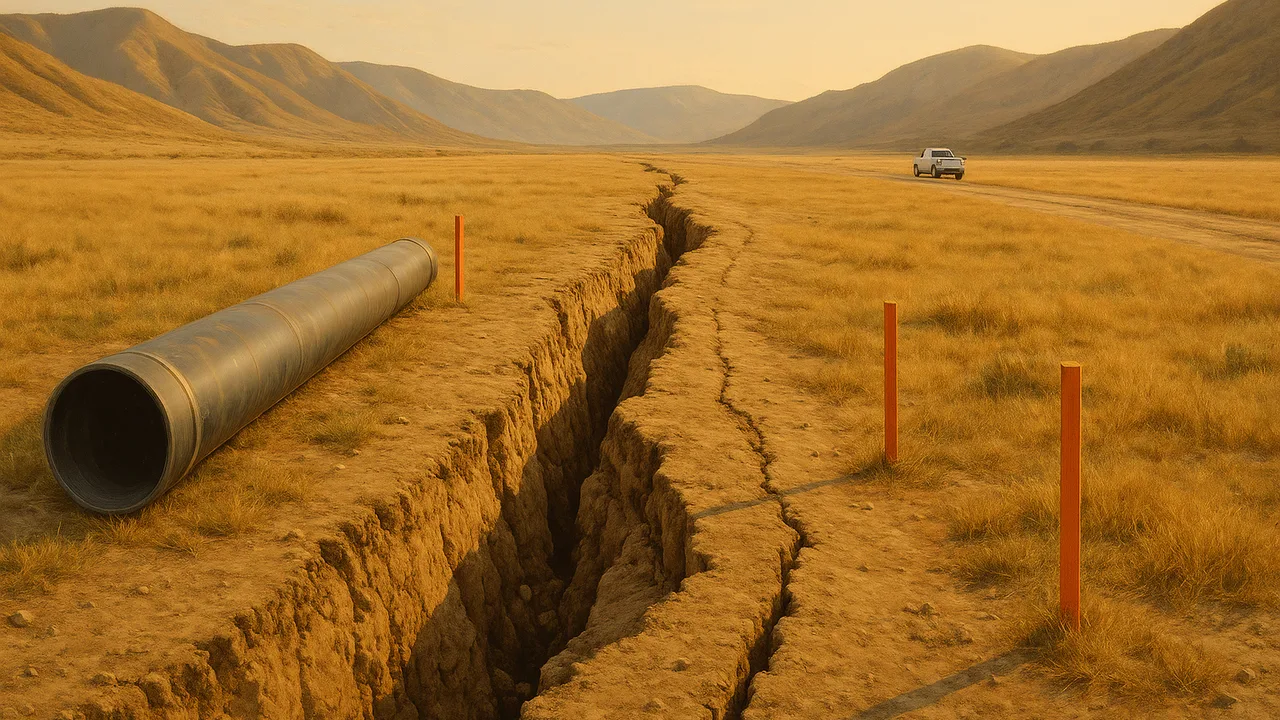
The Fault Crossing
How can we design a water-main crossing that survives the next large earthquake on a major strike-slip fault, and explain to the public, with evidence, why the fault is there and how it moves?
The mystery: A small stream flowing across a dry plain meets a major continental strike-slip fault, turns sharply to run along it for about 130 m, and then continues downhill: the stream channel has been offset by the fault.
Questions we will figure out together in this unit:
- How fast does the fault move, and is it always the same speed?
- Why is there a plate boundary here and not somewhere else?
- What is under the crust, and what makes the plates move?
- How far could the ground jump in one earthquake?
- How do scientists know when past earthquakes happened?
- Can a pipe be built to bend instead of break?
- Why is the ocean floor so much younger than the continents?
- Which sources about earthquakes can we trust?
define the water utility’s fault-crossing problem, sort our questions into need-to-knows, and judge which evidence about the fault is reliable enough to design with.
- I can identify the evidence that needs to be evaluated to explain the ages and patterns of crustal rocks.
- I can evaluate the reliability, strengths, and weaknesses of the given evidence and explain how well it supports arguments about plate motion.
Phase 1: Spark
Warm-Up ~5 min
Do Now. A water main is a large buried pipe that carries drinking water to a city. List two things that could happen to a buried pipe if the ground on one side of it suddenly moved 4 m sideways, and one thing the city would need right away if it broke.
A pipe is buried straight across a strike-slip fault. The fault slips 4 m in an earthquake. What happens to the pipe if nothing in the design allows for slip?
Instruction ~10 min
Meet the client. A regional water utility must replace an old water main that carries drinking water across the plain from our phenomenon. The new pipe has to cross the major strike-slip fault about 200 m from the offset stream channel. The utility’s chief engineer has asked our class for two things: a design for the crossing that keeps water flowing, or can be repaired fast, after the fault’s next large earthquake, and a clear public explanation of why the fault is there and how it moves, for the people the pipe serves.
Driving question. How can we design a water-main crossing that survives the next large earthquake on a major strike-slip fault, and explain to the public, with evidence, why the fault is there and how it moves?
Our mission. Geoscientists, this unit you will investigate seismic waves and Earth’s interior, measure how fast the fault slips, model how the plate boundary formed, design and test competing crossings, and present a scientific explanation with your tested design.
Need-to-knows. Sort the question board into three columns: what we already know, what we need to know, and how we could find out. Most need-to-knows fall under four headings: how we know plates move, what is inside Earth and drives them, how fast this fault moves and how much it slips at once, and how this boundary formed.
Worked example 1: which evidence do we need? The engineer needs one number above all: how far the ground might move at the crossing in one earthquake. To estimate it the team needs (1) the long-term slip rate, from a dated offset like the stream channel; (2) the time since the last large earthquake on this stretch; and (3) the slip in past earthquakes, from trenches dug across the fault. Evidence about continental fit or fossils supports plate tectonics in general but does not give this number. Knowing which evidence answers which question is the first skill of the unit.
Worked example 2: is this evidence reliable? (sample sources) Jamal’s team found three estimates of the fault’s slip rate.
| Source (sample) | Slip rate | Method and time span | Strengths | Weaknesses |
|---|---|---|---|---|
| A. Geologic study of the offset channel | about 35 mm/yr | 130 m offset, radiocarbon-dated, about 3,700 years | ||
| B. GPS network across the fault | about 34 mm/yr | stations on both sides, 20 years | ||
| C. Anonymous website | “about a meter a year” | none given |
A and B use different methods over very different time spans and still agree, so each makes the other more believable. C gives no method and is about thirty times faster than both; at a meter a year the stream would have been offset 130 m in just 130 years. We reject it. Strong evidence is checkable, has a stated method, and agrees with independent evidence.
Teams and roles. Teams of four rotate roles each week: Lead Geologist (keeps the team on the driving question), Data Analyst (calculations and graphs), Design Engineer (sketches and prototypes) and Public Communicator (writes the explanation for residents and presents).
Guided Exercises ~15 min
Use the sample source table and the question board.
Independent Practice ~10 min
Complete your team charter.
Fill in the strengths and weaknesses columns of the sample source table. Then name the evidence you would still need to judge whether the crust on the two sides of the fault is moving apart, together or sideways, and explain why.
Write the design problem in one or two sentences: who the pipe serves, what it must survive, and two criteria and two constraints for the crossing.
Closure ~5 min
We have a client, a driving question and teams. Next phase we investigate, starting with how seismic waves let us see inside Earth.
Exit ticket: name one need-to-know your team chose and the evidence that would answer it.
Teacher notes
Materials: the client letter (a one-page brief from a generic “regional water utility”), role cards, the sample source table, chart paper for need-to-knows.
Setup: the three slip-rate sources are sample sources for practice. The 35 mm/yr geologic rate and the agreement with GPS reflect real studies of large strike-slip faults, but the table is not a citation; say so if students ask.
Listen for: “any evidence for plate tectonics answers the engineer’s question”; treating every web page as equally reliable; “we can predict the date of the next earthquake.”
Support / stretch: give a partly filled need-to-know chart. Stretch: invite a civil engineer or a utility staff member to review the criteria by video call.