explain why societies in West Africa, the Byzantine Empire, Gupta India, China and the Muslim world expanded, how trade routes carried goods and ideas between them, and how geography connected or isolated their regions.
Instruction
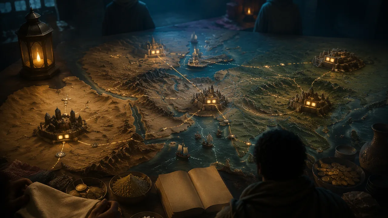
The medieval world was not a set of isolated kingdoms. From roughly 300 to 1450 CE, big societies grew, taxed their farmers, built capitals, and tied themselves together by roads, rivers, sea lanes and caravan tracks. This lesson asks why each of five societies expanded, what traveled along its roads, and how geography, which is what the standards call physical features such as deserts, mountains, rivers and seas, either connected or cut off one region from another.
Gupta India. The Gupta dynasty ruled much of northern India in the 300s and 400s CE; Chandragupta II reigned from 375 to 415. The Chinese pilgrim Faxian traveled in India between 399 and 414 and left the earliest eyewitness account in this lesson. He found a kingdom whose people did not have to register their households, whose king punished by fines, and whose cities supported charitable houses for the poor and the sick. Gupta-era scholars, including Aryabhata, advanced mathematics, including a place-value system. Faxian is also evidence for the exchange of ideas: he traveled from China to India to find the Buddhist books of discipline.
The Byzantine Empire. The Roman Empire in the east, which its people still called the Roman Empire, survived the fall of the western empire and lasted until Constantinople fell to the Ottomans in 1453. Under Justinian I (527-565) it briefly reconquered much of Italy. Its capital sat on the strait between the Black Sea and the Mediterranean, a geographic position that connected Europe and Asia. Byzantine silks, metalwork, enamels and illuminated manuscripts became popular in Western Europe.
The Muslim world. The Abbasid caliphs, who took power in 750, moved the capital to a new city, Baghdad, founded in 762 by al-Mansur. Baghdad hosted institutions like the House of Wisdom and a multi-ethnic, multi-religious population, and the Abbasids ruled from Iraq until 1258. Muslim merchants and scholars linked the Mediterranean, the Indian Ocean and the Sahara.
West Africa. The Sahara looks like a barrier on a map, but it carried one of the most valuable trades in the medieval world. Ibn Battuta crossed it in 1352 and described salt dug in slabs at Taghaza, carried south by camel, and sold at Iwalatan for eight to ten mithqals a load and in Mali for twenty to thirty, sometimes forty. The kingdom of Mali, reaching its peak under Mansa Musa, who made a famous pilgrimage to Mecca in the 1320s, controlled the gold-producing country to the south. Salt moved south, gold moved north, and with them went Arabic writing, Islam and scholars, so that a desert became a connection.
Song China. The Song dynasty issued the first banknotes in world history, and China’s population doubled between the tenth and eleventh centuries, helped by early-ripening rice. After 1127 the court moved south to Lin’an (now Hangzhou). Marco Polo, writing of the city he called Kinsay in the later 1200s, says he is repeating a written statement and gives huge numbers: twelve thousand bridges, twelve guilds. Treat those as claims, but the pepper detail, 43 loads a day at 223 pounds each, is a figure he says a customs officer gave him.
The Americas too. Cahokia, across the Mississippi River from present-day St. Louis, was a Native American city from about 1050 to about 1350. Around 1100 it covered about 6 square miles, had about 120 earthworks and a population of 15,000 to 20,000, and its residents traded for copper, chert, shark teeth and whelk shells with communities from the Great Lakes to the Gulf Coast. It was a contemporary of the Song state, and its rise came before the Mali of Mansa Musa; like them it was a city built on trade routes, in its case along the Mississippi.
📖 Read for this lesson
The reading opens over the lesson; close it to come back to exactly where you were. The checks below draw on it.
Formative check
Work through these before moving on. They are not graded — they tell you whether the standard below has landed yet.
Missouri standard: 9-12.WH.2.EC.A
Ibn Battuta says a load of salt sold for 8 to 10 mithqals at Iwalatan and 20 to 30 in Mali. What does the price gap show?
Missouri standard: 9-12.WH.2.G.A
The Sahara kept West Africa isolated from the rest of the medieval world.
Missouri standard: 9-12.WH.2.CC.A
Faxian reports that in the cities of the Middle Kingdom the Heads of the Vaisya families set up houses that gave charity and to the poor.
Missouri standard: 9-12.WH.2.CC.A
Which of these is a society whose expansion lasted until 1453?
Missouri standard: 9-12.WH.2.G.B
Compare Cahokia with the Song state. What did they share?
Missouri standard: 9-12.WH.2.CC.A, 9-12.WH.2.EC.A, 9-12.WH.2.G.A, 9-12.WH.2.G.B
Choose two of the five societies. For each, name (1) a good or idea that moved along its roads, (2) a physical feature that connected or isolated its region, and (3) one sentence of evidence from the reading. Then say which of your two societies was more connected to the rest of the medieval world, and why.
How confident are you that you can explain how medieval empires expanded, what traveled along their trade routes and how geography connected or isolated them?
Practice
Work these on paper or in your notebook, then open Check your answer. Aim for all of Fluency and Application; try at least one Challenge.
Printable version: this unit’s practice workbook (PDF)
Fluency
Build speed and accuracy with the core skill.
- Ibn Battuta says salt sold for 8 to 10 mithqals at Iwalatan and 20 to 30 in Mali. What are the smallest and largest ratios of the Mali price to the Iwalatan price you can form from those figures?
Check your answer
Answer: Smallest: 20/10 = 2 times. Largest: 30/8 = 3.75 times (the text adds that it sometimes reached 40, which would be 5 times).Smallest ratio pairs the lowest Mali price with the highest Iwalatan price; largest does the reverse. - Name the two goods that moved in opposite directions across the Sahara in Ibn Battuta’s account.
Check your answer
Answer: Salt moved south from Taghaza to the lands of the “negroes”; gold-dust came north in return, as the “hundredweights of gold-dust” show.The text says the business at Taghaza amounts to an enormous figure in hundredweights of gold-dust.
Application
Use the skill in context. Show your reasoning.
- Marco Polo says 43 loads of pepper, each 223 pounds, entered Kinsay daily. Compute the daily weight and the weight in a 365-day year, and say why a historian still treats the figure as a claim.
Check your answer
Answer: 43 x 223 = 9,589 pounds a day; 9,589 x 365 = 3,499,985 pounds a year. Polo is repeating what a customs officer told him, so it is a secondhand claim and cannot be checked against a record.Multiply, then source-check. - Faxian wrote that in the Middle Kingdom the people “have not to register their households, or attend to any magistrates and their rules.” Name one reason a historian cannot treat this as a full description of Gupta government.
Check your answer
Answer: He was a Buddhist pilgrim who passed through, wrote in praise of what he saw, and focused on monasteries; the passage does not name the king or describe taxes or courts in detail.Ask who wrote it, why, and what it leaves out. - Cahokia lay across the river from present-day St. Louis. Give two reasons that location supported long-distance trade.
Check your answer
Answer: It stood on the Mississippi, so goods could move by river; its residents traded for copper, chert, shark teeth and whelk shells with communities from the Great Lakes to the Gulf Coast.Rivers are the highways of a society without wheeled transport or pack animals.
Review
Keep earlier skills sharp.
- Review (sourcing): the three readings in this lesson are translations. Which of them did the translator publish in 1929?
Check your answer
Answer: Ibn Battuta, translated by H. A. R. Gibb.Faxian was translated by Legge in 1886; Polo by Yule and Cordier in 1903.
Caravans and Capitals: Pataliputra, Mali and Kinsay
Faxian, A Record of Buddhistic Kingdoms, trans. James Legge (Oxford: Clarendon Press, 1886), Project Gutenberg #64535; Ibn Battuta, Travels in Asia and Africa 1325-1354, trans. H. A. R. Gibb (London, 1929), Fordham Internet Medieval Sourcebook; Marco Polo, The Travels of Marco Polo, trans. and ed. Henry Yule and Henri Cordier, vol. 2, book II ch. LXXVI, Project Gutenberg #12410 · Public domain
Why this reading. Lesson 5.2 asks you to explain how goods and ideas moved along trade routes and why some societies prospered because of it. Here three travelers, writing about a thousand years apart, describe an Indian kingdom of the 400s, a West African empire and its salt road in 1352, and the Chinese capital that Marco Polo called Kinsay. Each is a witness with a point of view: a Chinese Buddhist pilgrim, a Moroccan judge and traveler, and a Venetian merchant who admits that he is quoting a document.
A. India, about 400 CE: a pilgrim describes the Middle Kingdom
Faxian (Fa-hien), A Record of Buddhistic Kingdoms, translated by James Legge (1886), chapters on the Middle Kingdom and on Pataliputra. Public domain. Faxian traveled in India between 399 and 414 CE according to Legge; the passage does not name the king.
“All south from this is named the Middle Kingdom. In it the cold and heat are finely tempered, and there is neither hoar-frost nor snow. The people are numerous and happy; they have not to register their households, or attend to any magistrates and their rules; only those who cultivate the royal land have to pay (a portion of) the grain from it. If they want to go, they go; if they want to stay on, they stay. The king governs without decapitation or (other) corporal punishments. Criminals are simply fined, lightly or heavily, according to the circumstances (of each case). Even in cases of repeated attempts at wicked rebellion, they only have their right hands cut off.”
“The cities and towns of this country are the greatest of all in the Middle Kingdom. The inhabitants are rich and prosperous, and vie with one another in the practice of benevolence and righteousness.”
“The Heads of the Vaiśya families in them establish in the cities houses for dispensing charity and medicines. All the poor and destitute in the country, orphans, widowers, and childless men, maimed people and cripples, and all who are diseased, go to those houses, and are provided with every kind of help, and doctors examine their diseases. They get the food and medicines which their cases require, and are made to feel at ease; and when they are better, they go away of themselves.”
B. West Africa, 1352: the salt road to Mali
Ibn Battuta, Travels in Asia and Africa 1325–1354, translated by H. A. R. Gibb (1929), account of the crossing of the Sahara and the visit to Mali, from the Fordham Internet Medieval Sourcebook. Public domain in the United States. Square brackets are the translator’s or editor’s.
“After twenty-five days [from Sijilmasa] we reached Taghaza, an unattractive village, with the curious feature that its houses and mosques are built of blocks of salt, roofed with camel skins. There are no trees there, nothing but sand. In the sand is a salt mine; they dig for the salt, and find it in thick slabs, lying one on top. of the other, as though they had been tool-squared and laid under the surface of the earth. A camel will carry two of these slabs. No one lives at Taghaza except the slaves of the Massufa tribe, who dig for the salt; they subsist on dates imported from Dar’a and Sijilmasa, camels’ flesh, and millet imported from the Negrolands. The negroes come up from their country and take away the salt from there. At Iwalatan a load of salt brings eight to ten mithqals; in the town of Malli [Mali] it sells for twenty to thirty, and sometimes as much as forty. The negroes use salt as a medium of exchange, just as gold and silver is used [elsewhere]; they cut it up into pieces and buy and sell with it. The business done at Taghaza, for all its meanness, amounts to an enormous figure in terms of hundredweights of gold-dust.”
“The negroes possess some admirable qualities. They are seldom unjust, and have a greater abhorrence of injustice than any other people. Their sultan shows no mercy to anyone who is guilty of the least act of it. There is complete security in their country. Neither traveller nor inhabitant in it has anything to fear from robbers or men of violence.”
“They do not confiscate the property of any white man who dies in their country, even if it be uncounted wealth. On the contrary, they give it into the charge of some trustworthy person among the whites, until the rightful heir takes possession of it.”
C. China, about 1275: Marco Polo describes Kinsay
Marco Polo, The Travels of Marco Polo, book II, chapter LXXVI, translated by Henry Yule, edited by Henri Cordier (1903). Public domain. Polo says he is reporting a written statement sent to the Mongol general Bayan; the figures are that document’s claims, and a historian treats them as claims. The editor’s note equates Kinsay with Hang-chau (Hangzhou).
“First and foremost, then, the document stated the city of Kinsay to be so great that it hath an hundred miles of compass. And there are in it twelve thousand bridges of stone, for the most part so lofty that a great fleet could pass beneath them. And let no man marvel that there are so many bridges, for you see the whole city stands as it were in the water and surrounded by water, so that a great many bridges are required to give free passage about it. [And though the bridges be so high the approaches are so well contrived that carts and horses do cross them.] The document aforesaid also went on to state that there were in this city twelve guilds of the different crafts, and that each guild had 12,000 houses in the occupation of its workmen. Each of these houses contains at least 12 men, whilst some contain 20 and some 40,—not that these are all masters, but inclusive of the journeymen who work under the masters. And yet all these craftsmen had full occupation, for many other cities of the kingdom are supplied from this city with what they require. The document aforesaid also stated that the number and wealth of the merchants, and the amount of goods that passed through their hands, was so enormous that no man could form a just estimate thereof. And I should have told you with regard to those masters of the different crafts who are at the head of such houses as I have mentioned, that neither they nor their wives ever touch a piece of work with their own hands, but live as nicely and delicately as if they were kings and queens. The wives indeed are most dainty and angelical creatures! Moreover it was an ordinance laid down by the King that every man should follow his father’s business and no other, no matter if he possessed 100,000 bezants.”
“Now Messer Marco heard it stated by one of the Great Kaan’s officers of customs that the quantity of pepper introduced daily for consumption into the city of Kinsay amounted to 43 loads, each load being equal to 223 lbs.”
About these excerpts. Every excerpt is word for word from the translation named, with footnote numbers removed. Passages not shown are omitted, not changed.
Sources: Faxian, A Record of Buddhistic Kingdoms, trans. Legge (Project Gutenberg #64535) (gutenberg.org); Ibn Battuta, Travels in Asia and Africa (Gibb), Fordham Internet Medieval Sourcebook (sourcebooks.fordham.edu); The Travels of Marco Polo, vol. 2 (Yule-Cordier), Project Gutenberg #12410 (gutenberg.org)