evaluate the evidence that continents and ocean floor move, and use plate tectonics to explain why ocean crust is young and continental crust can be very old.
Instruction
The phenomenon. At 12:59 p.m. on April 23, 2026, the ground shook about 1 km west-northwest of Cooter, a small town in Pemiscot County in the Missouri Bootheel. The USGS measured a magnitude 4.0 earthquake 11.8 km underground. More than 900 people reported feeling it to the USGS, from Memphis and Cape Girardeau to Columbia and Joplin. Nothing about that is unusual for a plate boundary. But Missouri is not on a plate boundary: the nearest one, the edge of the Caribbean plate south of Cuba, is roughly 2,000 km away. Something is still breaking the crust under the Bootheel, and in 1811-1812 it produced three earthquakes of about magnitude 7.3 to 7.5. To explain it, you first need the evidence that plates move at all.
An old idea with missing evidence. In 1912 Alfred Wegener proposed that the continents had once been joined and had drifted apart. His evidence: the coastlines of South America and Africa fit like puzzle pieces; identical fossils, such as the freshwater reptile Mesosaurus and the plant Glossopteris, appear on continents now separated by oceans; and rock belts and ancient glacial scratches line up when the continents are put back together. Most geologists rejected the idea because Wegener had no believable mechanism. The evidence that changed their minds came from the ocean floor.
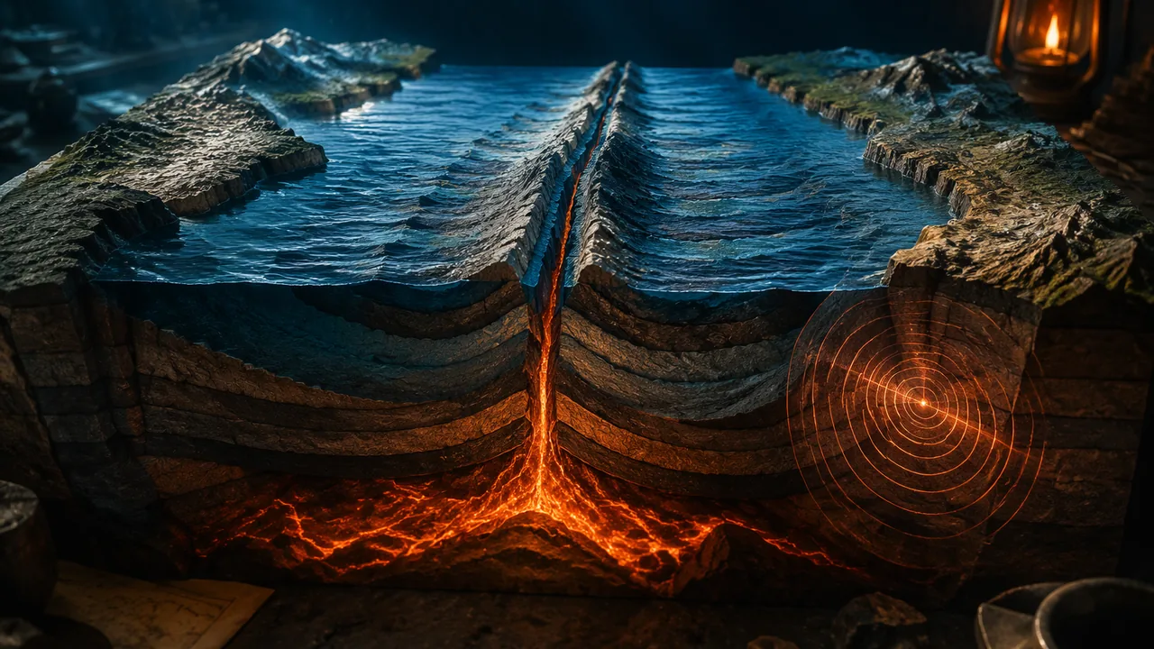
Evidence from the sea floor. After the Second World War, ships mapped the ocean floor with echo sounders. Marie Tharp and Bruce Heezen drew a mountain chain, the mid-ocean ridge, running through every ocean with a rift valley along its crest. Magnetometers towed behind ships then found stripes of rock magnetised alternately in the normal and reversed direction of Earth’s field, arranged symmetrically on both sides of the ridges. In 1963 Fred Vine and Drummond Matthews explained them: new crust forms at the ridge, records the magnetic field as its lava cools, and is carried away on both sides while the field reverses from time to time. The sea floor is a tape recorder.
Worked example: a spreading rate (illustrative numbers). The most recent magnetic reversal happened about 0.78 million years ago. Suppose the boundary between normal and reversed rock lies 39 km from the ridge axis. The rate is 39 km / 0.78 million years = 3,900,000 cm / 780,000 years = 5.0 cm per year on each side. Your fingernails grow at a few centimeters per year, which is about the speed of the plates.
The ages of crust. Drilling and magnetic dating show that ocean-floor age increases steadily away from the ridges, and the oldest ocean floor anywhere is only about 180 million years old. Continental rocks, by contrast, reach about 4.0 billion years (Unit 2), and Missouri’s own St. Francois Mountains are 1.48 to 1.45 billion years old. Plate tectonics explains the difference. Ocean crust is dense basalt; it forms at ridges and, when it grows old, cold and heavy, it sinks back into the mantle at subduction zones, so it never gets very old. Continental crust is thicker and less dense granite-like rock; it is too buoyant to sink, so it survives, gets deformed and grows at its edges.
Motion measured today, from Missouri. We no longer need to infer motion from rocks alone. GPS stations measure it directly, to fractions of a millimeter per year. Measured against Earth as a whole, every long-running GPS station in Missouri moves about 14 to 15 mm per year toward the west: station MACC in St. Francois County moves 14.5 mm/yr, and station PTGV at Portageville in the Bootheel 14.1 mm/yr. Missouri rides on the North American plate, and the whole plate moves together. Measure the same stations against the plate itself and almost nothing is left: Missouri’s stations differ from one another by less than about 1 mm per year across the whole state, and PTGV and a station 32 km away across the New Madrid Seismic Zone move together within their uncertainties. Now compare a station on a plate boundary. At Neah Bay, on the tip of Washington State, the Juan de Fuca plate is sinking under North America, and the locked boundary shoves station NEAH 14.6 mm/yr toward the northeast, relative to the rest of the plate. Over a human lifetime of 80 years, 14.6 mm per year adds up to 1.2 m; across the Bootheel it adds up to almost nothing. Your questions for this unit should aim at that contrast: If the middle of the plate barely deforms, why did it produce some of the largest earthquakes in U.S. history? Why here? What happens when it moves suddenly?
📖 Read for this lesson
The reading opens over the lesson; close it to come back to exactly where you were. The checks below draw on it.
Formative check
Work through these before moving on. They are not graded — they tell you whether the standard below has landed yet.
Where would you expect to find the OLDEST rock on the floor of the Atlantic Ocean?
Simulation & tools
Where do earthquakes happen?
Open the USGS Latest Earthquakes map. Use the settings (gear) menu to show magnitude 2.5+ earthquakes from the past 30 days, worldwide. Zoom out to the whole globe. Sketch or describe the pattern: do earthquakes scatter randomly, or do they form lines? Then change the setting to all magnitudes, past 30 days and zoom to the Missouri Bootheel and the Mississippi River near New Madrid. Record how many events you see there and the magnitude of the largest, and compare with the number of magnitude 2.5+ events along Alaska. Write one question about why a few small earthquakes cluster in the middle of a plate.
No device? Use the dated 30-day snapshot table of earthquake counts by region in this lesson’s reading.
Open U.S. Geological Survey ↗ · U.S. Geological Survey · Public domain (U.S. federal)
Why is no ocean floor older than about 180 million years, while continental rocks reach about 4 billion years?
If a magnetic stripe boundary 0.78 million years old lies 39 km from a ridge, the spreading rate on that side is cm per year; over 80 years, plates moving at 5 cm per year travel m.
Make a three-column evidence table: observation (continental fit, fossils, magnetic stripes, ocean-floor ages, GPS in Missouri and at Neah Bay), what it shows, and how strong it is. Then write two investigable questions about the Cooter earthquake or the New Madrid Seismic Zone for your unit question board.
How confident are you that you can evaluate the evidence for plate motion and explain why ocean crust is young and continental crust can be old?
Practice
Work these on paper or in your notebook, then open Check your answer. Aim for all of Fluency and Application; try at least one Challenge.
Printable version: this unit’s practice workbook (PDF)
Fluency
Build speed and accuracy with the core skill.
- A magnetic stripe boundary 2.0 million years old lies 60 km from a ridge axis. What is the spreading rate on that side, in cm per year?
Check your answer
Answer: 3.0 cm/yr60 km = 6,000,000 cm; divide by 2,000,000 years. - Sea floor 900 km from a ridge moved away at 2.5 cm/yr. How old is it?
Check your answer
Answer: 36 million years900 km = 9 × 107 cm; divide by 2.5 cm/yr. - GPS station MACC in St. Francois County, Missouri, moves 14.5 mm/yr toward the west, measured against Earth as a whole. How far does it move in 25 years?
Check your answer
Answer: about 0.36 m (362.5 mm)14.5 mm/yr × 25 yr = 362.5 mm.
Application
Use the skill in context. Show your reasoning.
- The Atlantic is about 5,000 km wide and widens at about 2.5 cm/yr (full rate). About how long ago did it start to open, assuming a steady rate?
Check your answer
Answer: about 200 million years5,000 km = 5 × 108 cm; divide by 2.5. - Explain why the oldest ocean floor is about 180 million years old while continental rocks reach 4 billion years.
Check your answer
Answer: Ocean crust forms at ridges and, as it ages and becomes dense, sinks back into the mantle at subduction zones; buoyant continental crust is not subducted, so it survives. - A volcanic island 480 km from a hotspot is 5.0 million years old (illustrative values). How fast has the plate moved over the hotspot?
Check your answer
Answer: 9.6 cm/yr
Challenge
Stretch problems. Expect to think before you write.
- If a 10,000 km-wide ocean plate moves toward a trench at 5.5 cm/yr, how long does it take for crust formed at the ridge to reach the trench? Compare with the age of the oldest ocean floor.
Check your answer
Answer: about 182 million years, close to the oldest ocean floor (about 180 million years)10,000 km = 109 cm; divide by 5.5.
Review
Keep earlier skills sharp.
- A wood sample has 12.5% of the carbon-14 of living wood. Using a half-life of 5,730 years, estimate its age.
Check your answer
Answer: ≈ 17,190 yearst = 5730 × log2(100/percent remaining). - A wood sample has 35% of the carbon-14 of living wood. Using a half-life of 5,730 years, estimate its age.
Check your answer
Answer: ≈ 8,679 yearst = 5730 × log2(100/percent remaining).
The Sea-Floor Evidence in USGS’s Words, GPS Velocities from Missouri and a Plate Boundary, and a Dated 30-Day Earthquake Snapshot
USGS, This Dynamic Earth (Kious and Tilling), online edition; USGS ComCat event nm60620376 and FDSN counts of M2.5+ earthquakes 2026-10-06 to 2026-11-05 UTC; Nevada Geodetic Laboratory MIDAS velocity files (IGS14 and NA frames; Blewitt and others 2016); ICS chart v2023/09 (Chibanian base 0.774 Ma); all retrieved November 6, 2026 · SLS original (cites USGS public-domain text and catalog data, Nevada Geodetic Laboratory GPS velocities and the CC BY 4.0 ICS chart; brief quotations only)
Why this reading. The lesson’s evidence table asks you to rate the evidence that plates move, and its GPS paragraph compares Missouri with a station on a plate boundary. Here is the sea-floor evidence in the U.S. Geological Survey’s own words, the GPS velocities behind the lesson’s numbers (retrieved November 6, 2026), a dated table of real earthquake counts by region for the map task, and the Cooter earthquake facts the lesson opens with.
1. The phenomenon, from the USGS catalog
USGS ComCat event nm60620376: magnitude 4.0 (moment magnitude), April 23, 2026, 17:59:04 UTC (12:59 p.m. Central Daylight Time), “1 km WNW of Cooter, Missouri”, at 36.054°N, 89.826°W and 11.8 km depth. The event summary lists 913 “Did You Feel It?” reports and a maximum community intensity of 4.3. In the ZIP-code table, the farthest Missouri reports came from Monroe City and Joplin, both 432 km away; Memphis and Cape Girardeau reported intensities near 3. Distance to the nearest plate boundary: the Cayman Trough at the edge of the Caribbean plate passes near 18.5°N, 86°W, about 1,990 km from the epicenter by great-circle distance (SLS computation). The 1811-1812 magnitudes (7.5, 7.3, 7.5) are those in the USGS summary of the sequence (see the reading on the New Madrid USGS sources).
2. The sea-floor evidence, as USGS states it
From This Dynamic Earth, the USGS account of plate tectonics:
- Wegener’s evidence included “distinctive fossil ferns (Glossopteris) discovered in now-polar regions, and the occurrence of glacial deposits in present-day arid Africa”.
- Magnetic striping: “Alternating stripes of magnetically different rock were laid out in rows on either side of the mid-ocean ridge: one stripe with normal polarity and the adjoining stripe with reversed polarity.” Spreading was supported because “(1) at or near the crest of the ridge, the rocks are very young, and they become progressively older away from the ridge crest; (2) the youngest rocks at the ridge crest always have present-day (normal) polarity; and (3) stripes of rock parallel to the ridge crest alternated in magnetic polarity.”
- Ages: scientists dated the striping “for nearly all of the ocean floor, parts of which are as old as 180 million years.”
- Rates: “The rate of spreading along the Mid-Atlantic Ridge averages about 2.5 centimeters per year (cm/yr), or 25 km in a million years.”
3. The reversal age and the spreading-rate example
The most recent reversal (the Brunhes-Matuyama boundary) defines the base of the Chibanian age on the International Chronostratigraphic Chart (v2023/09) at 0.774 million years. The lesson’s illustrative example uses 0.78 million years and 39 km: 3,900,000 cm / 780,000 yr = 5.0 cm/yr; with 0.774 it is 5.04. Over 80 years, 5 cm/yr gives 400 cm = 4 m.
4. Table 1. GPS velocities (Nevada Geodetic Laboratory, MIDAS)
The Nevada Geodetic Laboratory processes data from thousands of permanent GPS stations and publishes a velocity for each, both in a global frame (IGS14, which measures motion against Earth as a whole) and in a frame that holds the North American plate fixed. Files midas.IGS14.txt and midas.NA.txt, retrieved November 6, 2026; method: Blewitt and others (2016). Speeds are the horizontal velocity, rounded.
| Station | Where | Data span (decimal years) | Speed against Earth as a whole, IGS14 frame (mm/yr) | Speed against the North American plate, NA frame (mm/yr) | Typical uncertainty (mm/yr) |
|---|---|---|---|---|---|
| MOBF | St. Louis County, Mo. | 2012.0-2024.7 | 15.2 toward the west | 0.92 toward the north-northwest | ±0.16 |
| MOJC | near Jefferson City, Mo. | 2009.8-2024.7 | 14.4 toward the west | 1.20 toward the north-northeast | ±0.17 |
| MOSF | near Springfield, Mo. | 2009.7-2024.7 | 14.2 toward the west | 0.85 toward the north-northeast | ±0.16 |
| MACC | St. Francois County, Mo. | 1999.8-2024.7 | 14.5 toward the west | 1.21 toward the north | ±0.14 |
| PTGV | Portageville, Mo. (Bootheel) | 1999.2-2024.7 | 14.1 toward the west | 1.29 toward the north | ±0.14 |
| RLAP | near Reelfoot Lake, Tenn., 32 km east of PTGV | 1997.8-2024.7 | 14.3 toward the west | 1.07 toward the north | ±0.17 |
| NEAH | Neah Bay, Wash. (Cascadia plate boundary) | 1996.0-2024.7 | 5.5 toward the south-southwest | 14.57 toward the northeast | ±0.17 |
| KOD5 | Kodiak, Alaska (Aleutian plate boundary) | 1996.1-2019.9 | 17.2 toward the west | 22.04 toward the north-northwest | ±0.40 |
| MKEA | Mauna Kea, Hawaii (Pacific plate) | 1996.8-2024.7 | 71.9 toward the west-northwest | not listed (station is on another plate) | ±0.17 |
Reading the table. Against Earth as a whole, the Missouri stations all move 14 to 15 mm/yr toward the west: the whole plate is moving, carrying Missouri with it. Hawaii’s Mauna Kea, on the Pacific plate, moves about 72 mm/yr toward the west-northwest, five times faster and in a different direction; the boundary between such plates is where the crust breaks. Against the North American plate, the Missouri stations keep only about 1 mm/yr, nearly all of it a shared northward drift that comes from how the “fixed North America” frame is defined for the whole continent; what matters for a fault is the difference between nearby stations. PTGV and RLAP sit on opposite sides of the New Madrid Seismic Zone, 32 km apart. Their difference is -0.17 mm/yr east and -0.23 mm/yr north, a relative speed of 0.29 mm/yr, with an uncertainty of about ±0.22 mm/yr in each direction: not distinguishable from zero. Published studies with more stations put the bound below 0.2 mm/yr (Lesson 3.3). Neah Bay and Kodiak, on plate boundaries where an ocean plate is sinking under North America, are shoved 14.6 and 22.0 mm/yr toward the continent relative to its stable interior, because the locked boundary drags the edge of the plate. That is the contrast the lesson builds on.
Worked. MACC, 14.5 mm/yr × 25 yr = 362.5 mm ≈ 0.36 m. NEAH relative to the plate, 14.6 mm/yr × 80 yr = 1,168 mm ≈ 1.2 m. PTGV-RLAP, 0.29 mm/yr × 80 yr = 23 mm, smaller than its own uncertainty.
5. Table 2. Where earthquakes happened in 30 days (USGS catalog snapshot)
USGS ComCat, earthquakes of magnitude 2.5 and above from 2026-10-06 to 2026-11-05 UTC, counted inside latitude-longitude boxes. The live map shows today’s; this snapshot will not change.
| Region (box) | Setting | M2.5+ earthquakes in 30 days |
|---|---|---|
| Whole world | — | 2,089 |
| Alaska and the Pacific Northwest (42-62°N, 170-120°W) | Subduction zones | 389 |
| Indonesia and New Guinea (12°S-8°N, 95-155°E) | Subduction zones | 185 |
| Chile and Peru (45-5°S, 80-66°W) | Subduction zone | 64 |
| Japan (30-46°N, 128-148°E) | Subduction zones | 57 |
| Central United States plains (35-49°N, 105-85°W) | Plate interior | 9 |
| Interior Brazil and Argentina (35-5°S, 65-40°W) | Plate interior | 4 |
| Northern Europe (50-70°N, 0-30°E) | Plate interior | 1 |
| Western Australia (35-15°S, 112-130°E) | Plate interior | 0 |
| Sahara (15-32°N, 15°W-30°E) | Plate interior | 0 |
The four plate-boundary boxes hold 695 of the month’s 2,089 earthquakes; the five plate-interior boxes hold 14. Earthquakes line up along boundaries. The largest in the Alaska box was a magnitude 5.5 on October 6, 92 km north-northwest of Aleneva, Alaska, 88 km deep. In the New Madrid box (35-38°N, 91-88°W) the same month had 1 earthquake of magnitude 2.5 or more (M2.6 on October 16, 9 km west-southwest of Equality, Illinois) and 16 of magnitude 1.0 or more, most of them near Tiptonville, Tennessee, and Risco and Holland, Missouri: a small, persistent cluster in the middle of the plate.
6. Table 3. The evidence table, with numbers to rate
| Observation | What it shows | The number that lets you rate it |
|---|---|---|
| Continental fit and matching fossils | The continents were joined | Glossopteris and glacial deposits in now-tropical Africa (USGS); suggestive, but no rate and no mechanism |
| Magnetic stripes | New crust forms at ridges and moves away, recording reversals | Stripes symmetrical about ridges (USGS); most recent reversal 0.774 million years ago (ICS) |
| Ocean-floor ages | Ocean crust is young and recycled | Oldest floor about 180 million years (USGS) against 1,480 million years for the St. Francois Mountains and about 4,000 million for the oldest continental rocks (Unit 2) |
| GPS | The plates move today; the middle of a plate barely deforms | Missouri 14-15 mm/yr with its plate; across the New Madrid zone 0.29 ± 0.22 mm/yr; Neah Bay 14.6 mm/yr relative to the plate |
| Earthquake locations | Boundaries are where the crust breaks, with rare exceptions | 695 of 2,089 earthquakes in four boundary boxes against 14 in five interior boxes in one month |
Sources: USGS, This Dynamic Earth: Developing the theory (pubs.usgs.gov); USGS, This Dynamic Earth: Magnetic stripes and isotopic clocks (pubs.usgs.gov); USGS, This Dynamic Earth: Understanding plate motions (pubs.usgs.gov); USGS, This Dynamic Earth: Historical perspective (pubs.usgs.gov); USGS event page, M 4.0 – 1 km WNW of Cooter, Missouri (nm60620376) (earthquake.usgs.gov); USGS Did You Feel It? ZIP-code table for nm60620376 (earthquake.usgs.gov); USGS FDSN event web service (count queries for Table 2) (earthquake.usgs.gov); Nevada Geodetic Laboratory, MIDAS velocities, North America frame (geodesy.unr.edu); Nevada Geodetic Laboratory, MIDAS velocities, IGS14 frame (geodesy.unr.edu); Nevada Geodetic Laboratory, MIDAS velocity file README (geodesy.unr.edu); ICS International Chronostratigraphic Chart v2023/09 (CC BY 4.0) (stratigraphy.org)